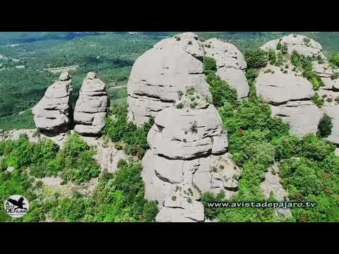
Nestled in the Caribbean Sea, the small island of Montserrat boasts a landscape that is both enchanting and dramatic. Known for its lush greenery and the active Soufrière Hills Volcano, Montserrat presents unique challenges and spectacular scenery that make it an ideal candidate for video drone technology. In recent years, drones have become an invaluable tool for capturing this remote island’s beauty from above, providing a fresh perspective on its natural wonders and aiding in various scientific and safety operations.
#### The Impact of Drones on Tourism
Montserrat’s tourism industry has harnessed the power of drone technology to promote its stunning vistas and untouched environments to a global audience. Aerial videos produced by drones offer potential visitors a new way to experience the island before they even set foot on it. From soaring over the ash-covered remains of Plymouth, the island’s former capital, to gliding along the rugged coastlines and hovering above dense rainforests, drones capture compelling footage that can significantly boost tourism interest.
Video drones are not just tools for creating mesmerizing promotional content; they also provide practical solutions for mapping hiking trails and inaccessible areas. This information is crucial for developing safe and enjoyable tourist routes, enhancing visitors’ experiences while ensuring their safety.
#### Scientific Research and Environmental Monitoring
The versatility of video drones extends beyond tourism into more critical applications like scientific research and environmental monitoring. Montserrat’s active volcano, which has shaped much of the island’s recent history through periodic eruptions since 1995, is under constant scrutiny by scientists from around the world.
Drones equipped with video cameras and other sensory equipment can safely gather data from areas that are otherwise hazardous for humans. They provide real-time insights into volcanic activity, including changes in topography, gas emissions, and possible lava flow paths. This data is vital for local authorities to maintain up-to-date risk assessments and evacuation plans.
Moreover, environmentalists use drones to monitor wildlife populations and vegetation health across different parts of the island. This technology facilitates a non-intrusive method of studying sensitive ecosystems and helps in documenting changes over time due to natural or human-induced factors.
#### Enhancing Safety and Emergency Response
In disaster-prone regions like Montserrat, quick response times can save lives during emergencies such as volcanic eruptions or tropical storms. Video drones play an essential role in disaster management by providing emergency responders with detailed aerial views without risking personnel. These views help in assessing damage, locating stranded individuals, and planning effective response strategies.
Furthermore, with their ability to be deployed quickly and maneuver across difficult terrains without needing clear pathways, drones are perfect for delivering emergency supplies such as medicine or food to cut-off areas during prolonged crises.
#### Challenges Facing Drone Operations
Despite their numerous benefits, operating video drones in Montserrat comes with challenges. The regulatory framework governing drone usage needs continuous updates to address privacy concerns while balancing innovation growth. There are also technical difficulties related to flying in harsh weather conditions frequently experienced on the island which can hinder drone operations.
### Conclusion
Video drone technology has undoubtedly transformed how we interact with remote natural environments like those found on Montserrat. As these devices continue improving in functionality while decreasing in cost—coupled with supportive regulations—we can expect further integrations of drone usage across multiple facets from tourism promotion to scientific researches contributing positively not only towards enhanced visitor experiences but also towards critical monitoring activities essential for ecological conservationCultural heritage preservationrecovery planning after natural disasters.
