Nestled on the banks of the majestic Guayas River, Guayaquil, Ecuador’s largest city and chief port, offers an enchanting blend of vibrant city life and serene natural landscapes. As we explore Guayaquil from an aerial drone perspective, the city reveals its charm and unique character that might not be as apparent from the ground.
#### Historical Richness from Above
The heart of Guayaquil is its rich history, visible through its colonial architecture and historic neighborhoods. From a bird’s-eye view, one can truly appreciate the layout of Las Peñas neighborhood, where colorful houses cling to the side of Santa Ana Hill. Ascend with your drone from the base up to the iconic lighthouse at the top and capture panoramic views of the city juxtaposed against the river.
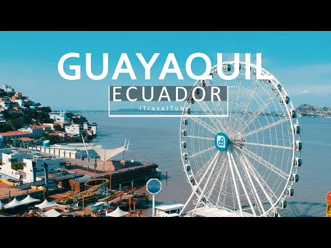
Aerial footage also brings a new dimension to landmarks such as La Rotonda on the Malecón 2000. This famous monument commemorates a historic meeting between South American liberators Simón Bolívar and San Martín. Capturing this site from above allows for sweeping views of the promenade stretching along the river, offering glimpses into both historical and modern day Guayaquil.
#### Urban Greenery
Moving inland from historic districts, aerial cameras highlight Guayaquil’s commitment to green spaces amidst urban sprawl. Parque Seminario, commonly known as Iguana Park due to its resident iguana population, is a surprising element amidst urban architecture. An aerial view not only captures these green reptiles lounging by ornate ponds but also showcases families enjoying this oasis in the city center.
Drone footage over Parque Histórico offers another lush retreat with an added cultural twist. This park-museum hybrid presents zones that reflect different aspects of Ecuadorian history and biodiversity—from colonial buildings relocated from downtown to habitats showcasing native flora and fauna like sloths and macaws.
#### Industrial Vibrancy by Air
Guayaquil is not only about historical sights or green parks; it’s also a vital economic hub with bustling ports that look particularly impressive when filmed from above. The Port of Guayaquil is one of South America’s busiest sea ports and seeing container ships being loaded and unloaded with goods in rapid succession underscores Ecuador’s role in global trade more powerfully than any ground-level view could manage.
Drones capture sprawling industrial areas transitioning into urban zones seamlessly—an interplay between commerce and daily life that defines much of Guayas’ capital.
#### Cultural Celebrations from a New Perspective
Guayaquil is renowned for its lively festivals such as ‘Las Fiestas de Guayaquil,’ which celebrate independence each July with fireworks, parades, music, and dance. Capturing these festivities through drone photography allows viewers to experience the scale and atmosphere in immersive detail; fireworks become intricate light patterns while parades showcase colorful costumes across bustling streets.
#### Night Views
As day turns to night, drones equipped with high-quality cameras take majestic footage showing how modern-day lighting plays on water features along malecóns (waterfront promenades) or highlights architectural features against dark skies—a different yet equally charming vision compared to daytime vibrancy.
### Conclusion
In summary, exploring Guayaquil through aerial drone technology transforms our perception by providing unique angles that suggest both breadth—covering expanses like ports—and intimacy—zooming into crowded festivals or tranquil parks. Whether you’re planning your next travel adventure or just enjoying virtual tours around world cities like this pulsating Ecuadorian metropolis, drone footage offers insights unseen by conventional tourism paths—a testament to how technology continues reshaping our exploration narratives.